-
 Overview
Centre Testing International Group Co., Ltd. (CTI) is a market leader in testing, inspection, certification, calibration, audit, training & technical services; building trust between governments, enterprises, and consumers.
-
 Sustainability
By building a full value chain ESG governance system covering the strategic decision-making level, management execution level and business operation level, it actively practices penetrating management of ESG risk and opportunities, empowering sustainable development across the industry chain.
-
 Our service
Centre Testing International Co., Ltd. (CTI) is the pioneer and leader in the TIC Industry which provides one-stop solutions on testing, inspection, certification, calibration, audit, training & technical services.
-
By Industry
Our service capabilties cover the upstream and downstream of the supply chain including textile and apparel,toys,electronic appliances,medical health,food...andother industries.
-
 Environment
-
 Raw Material & Fuel Chemicals
-
 Textiles, Apparel, Footwear & Accessories
-
 Food & Agricultural Products
-
 Cosmetics, Personal Care & Household Chemicals
-
 Building Materials&Construction Engineering
-
 Electronic & Electrical Appliances
-
 Toys, Furniture & Home Decoration
-
 Industrial Equipment & Manufacturing
-
 Rail & Aviation
-
 Automotive & Spare Parts
-
 Pharma and Medical Services
-
 Maritime Vessel Compliance Testing
 By Industry
Our service capabilties cover the upstream and downstream of the supply chain including textile and apparel,toys,electronic appliances,medical health,food...andother industries.
-
-
 Specialty
Comprehensively guarantee quality and safety, promote compliance and innovation, demonstrate brand competitiveness, and achieve higher quality, healthier, safer, and greener sustainable development.


-
 Management
We have established a clear governance structure in accordance with listing requirements and national regulations and policies to deal with internal and external challenges and achieve sustainable development.
-
 Information DisclosureWe are committed to establishing normal and effective two-way communication with shareholders and investors. We have established a complete information disclosure mechanism to convey information to shareholders in a timely manner.

-
 Talents Policy
Ensuring the basic rights and benefits of employees;
Providing professional skills training to promote employees’ growth;
Carrying out various kinds of activities to balance employees’ work and life.
-
 RecruitmentWelcome to join CTI family! We are providing a platform for you to show your talents and achieve your career aspiration.

QUALITY & VALUE
Home > Our Services > Environment > Geomatics > Geomatics > Service Details
Through all-round and multi-element comprehensive survey of ocean water and seabed, various information and data including atmosphere, hydrology, seabed topography, landform, substrate, gravity, magnetic force and other information and data are obtained, and thematic maps are drawn for different purposes and purposes, so as to serve navigation, national defense construction, Marine development and Marine research.
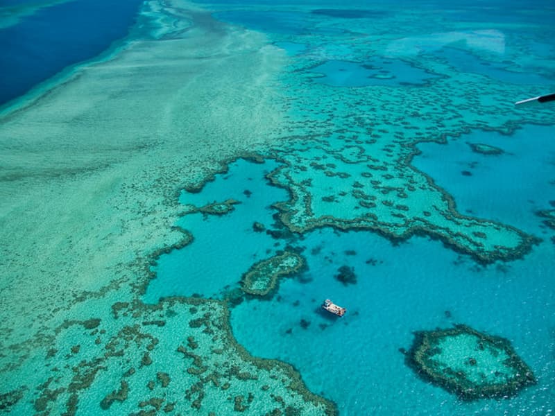
◉ Service Background
CTI has national Grade B surveying and mapping qualification, and has A number of professional senior engineers of Marine surveying and mapping, registered surveying and mapping, and A level of international hydrographic surveyors. We will make use of our own professional technology, rich experience and perfect equipment, to provide customers with professional Marine mapping services, help customers to break waves, embrace the ocean.
◉ Service Content
|
Bathymetric survey |
The determination of the height and plane position of the bottom point to the water surface is the central link of hydrographic survey and submarine topographic survey. The purpose is to determine the exact position of various navigation obstacles such as reefs and sunken ships, and to explore the shallowest water depth and its extension range. |
|
Hydrological observation |
In order to understand the distribution and variation of Marine hydrological elements, the observation and observation items are determined with the investigation tasks, generally including: water depth, water temperature, ocean current and other observations. |
|
marine engineering survey |
To carry out topographic and geomorphic survey and obstacle detection in the sea areas where Marine engineering is carried out. |
|
sweeping survey |
The purpose is to find out the navigation obstacles in the sea area, and to determine the depth of safe navigation of the ship refers to the measurement of the position of the shallowest and deepest underwater obstacles within the anchorage area of the port channel. |
|
coastal topographic survey |
The determination of the position and nature of the shoreline and the survey and survey of coastal land topography. |
|
sea area ownership mapping |
It includes the verification of territorial sea ownership, the definition of territorial sea boundary site, the measurement of sea register area, and the inspection and surveying of sea area for the completion of territorial sea chart. |
◉ Solution
CTI provides accurate and efficient ocean surveying and mapping solutions for different project requirements under the support of professional surveying equipment, the cooperation of professional surveying personnel, the guidance of professional operation process, and the management of professional working system.
◉ Our Strengths
☆ Full talent reserve: with professional qualifications, experienced technical team, to provide you with professional consulting and services..
☆ Advanced production equipment: advanced Marine equipment, to ensure the accuracy and reliability of measurement data.
☆ Perfect enterprise qualification: with a series of qualifications such as national surveying and mapping Grade B qualification, quality management system, etc.
☆ Extensive service coverage: enterprises set up laboratories in coastal areas to make full use of their geographical location and radiate to surrounding areas.
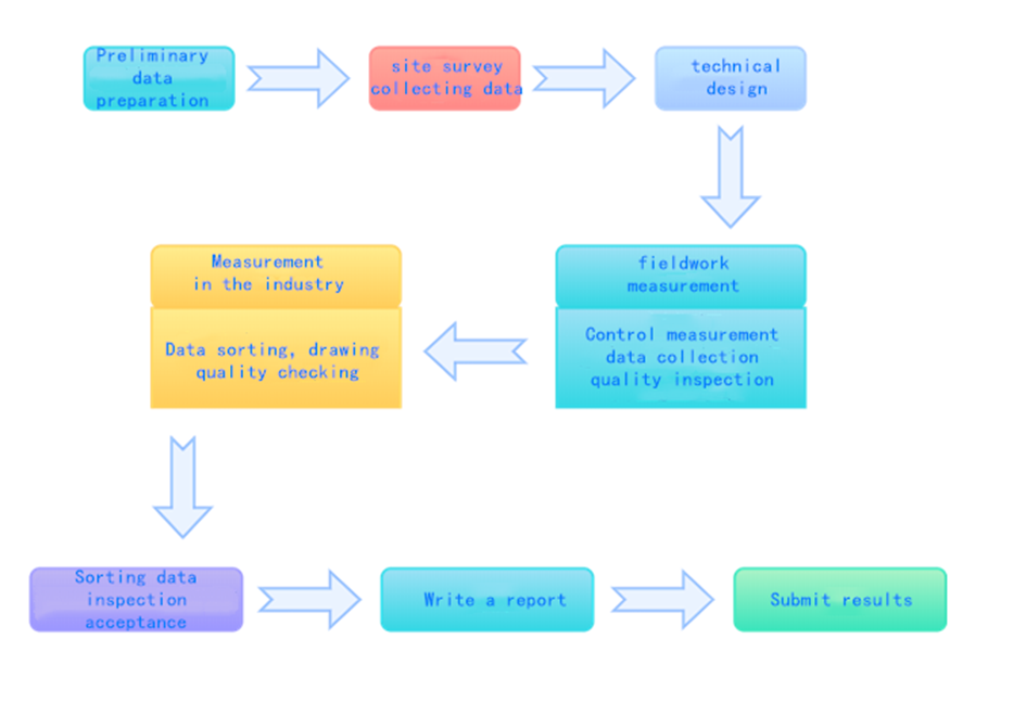
◉ Service Process
◉ Q&A
Q: Is there a confidentiality mechanism?
A: The company is equipped with secret-related computers to establish a sound confidentiality system to ensure the safety of surveying and mapping results; It shall be equipped with a special storage room for results data, and its managers shall all pass the post training examination for managers of confidential surveying and mapping results organized by the National Administration of Surveying and Mapping And Geographic Information; Conduct confidentiality training for all employees of the company and sign confidentiality agreements.
Q: Is there a sound after-sales service?
A: The company has a professional after-sales team will regularly visit customers to help customers solve problems; And promised to respond within 12 hours and resolve the problem within 24 hours after receiving feedback from users.
◉ Cooperation Case
☆ Zhejiang Wenzhou Port area surrounding the sea dumping area delineation service
☆ Follow-up monitoring and after-effect evaluation of the shoreline improvement and restoration project from xinkai Estuary to Nanshan River in Qinhuangdao
☆ Monitoring and evaluation of Marine ecological restoration projects in Huludao City
☆ Preliminary selection of temporary mud pit depth monitoring for Tianjin LNG Project
☆ Bathymetric survey project of dredging materials in temporary Marine dumping area of Qinzhou Port, 300,000-ton waterway dredging project
-
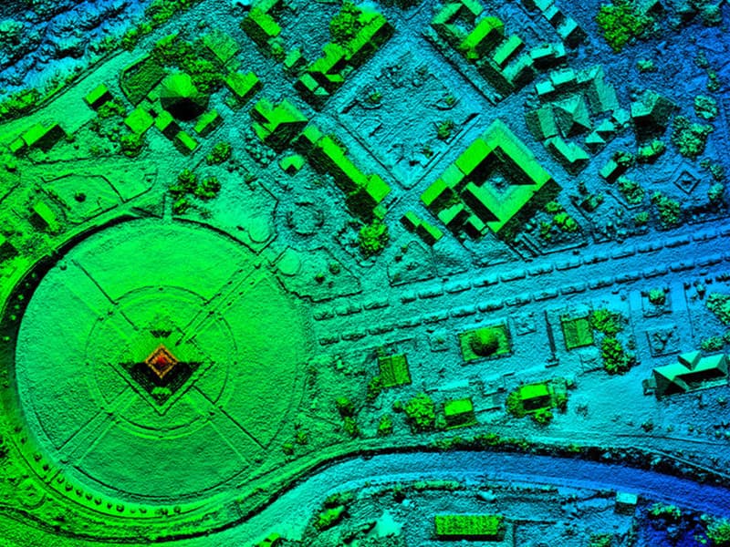 Photogrammetry and Remote SensingPhotogrammetry and remote sensing technology has been widely used in surveying and mapping, agriculture, forestry, water conservan...More
 -
 Engineering SurveyingEngineering survey is an important part of project construction, it can improve the overall quality of the project, go smoothly, p...More
 -
 Real Estate Surveying and MappingReal estate surveying and mapping is widely used in cadastral survey and cadastral database construction, real estate surveying an...More
 -
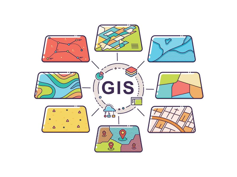 Geographic Information EngineeringGeographic Information System (GIS) is widely used in land, surveying and mapping, planning, water conservancy, geology, public se...More

Integrity statement | Privacy Policy | Global service network | Complain/Report | Declaration Statement | Website map | General Terms and Conditions Copyright Centre Testing International All rights reserved
 粤公网安备 44030602000441号